

Wye Rivers
The Wye's 4,000 Square Km catchment is home to numerous rivers, mountain ranges, moorland plateaus and lowland hills feeding the main channel with a plethora of life there. Here we take a snap shot of the Wye rivers whilst including the diaries from our multi day river hikes, which are long but 'Optional.' Explore the Wye's tributaries therefore through our eyes and be surprised by the area through which they flow.
Key
River Lugg - River Frome - River Arrow - River Honddu - River Monnow - River Ennig - River Llynfi - River Edw - River Irfon - River Angidy - River Trothy - River Dore -River Elan - River Bachawy - River Ithon - Rivers Tarennig & Bidno - River Marteg - River Wye
01 Enter
River Lugg/Mid/Lower
Location: Radnor Forest
Powys Wales (Map)
Parking: Farmstead GR SO184729
Public Transport: Llanbister Heart of Wales
Source GR: SO171749 - Length/Flow: 63 Length in Miles: 63 Miles
The Lugg is the Wye's largest tributary contributing 20% of its flow and starts from a small depression on Pool Hill in Radnorshire. From there it flows through a ravine providing a great day out. Glyndwrs Way a trail that celebrates Owain Glyndwr the 12th C Welsh independence campaigner skirts the source. The river passes through Presteigne, Leominster and Hereford discharging into the Wye at Mordiford adjacent to the Famed Woolhope Dome.
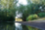
River Frome/Lower
.jpg)
ILocation: Thornbury
Parking: None Available
Public Transport: Bromyard DRM Buses
Source GR: SO610607
Length Flow: 26 Miles
Nearest Town to Source: Bromyard
02 Enter
The Frome is a narrow sub tributary of the Wye winding its way through North Herefordshire via the market town of Bromyard. It's source starts unceremoniously out of a pipe in a copse. Although not pretty it's contrasted by many orchards and hop fields in the surrounding rolling countryside, which is peppered with rights of way. A planned short walk along the river is recommended for the bucolic scene, which will take you through to Bishops Frome, Yarkhill and around the base of the famed Woolhope Dome. The annual Bromyard Folk and Nozstock Hidden Valley Festivals take place amid the rivers course each year.

03 Enter
River Arrow/Lower
Location: Gwuenceste Hill
Powys Wales (Map)
Parking: Forest Inn GR SO170585
Public Transport: Llanfihangle Nant Melan Sargeants Buses
Source GR: SO166554
Length Flow:45 Miles
Nearest Town to Source: Kington
The Arrow is another sub tributary river that flows through Kington in Herefordshire whereupon it enters the Lugg downstream South of Leominster. The source is a deep cut ravine that can be hiked all the way to the top where views of the range and the Black Mountains to the South East can be enjoyed. This is for fit and capable walkers. Nearby is the Offa's Dyke path national trail, which passes through Newchurch where you can get some refreshments at St Mary's Church if hiking the path or river into Kington.
04 Enter
River Honddu/Mid
Location: Black Mountains
Parking: Hay Bluff GR SO239373
Public Transport: T14 Hay On Wye
Source GR: SO245362
Length Flow: 24 Miles
Nearest Town to Source: Hay-On-Wye

The Honddu is a mountain stream feeding the Monnow then the Wye that starts high up in the Hay Bluff/Black Mountain interior. It's a wild part of the range rarely visited. Inside it's cathedral like providing the explorer with an impressive sense of the mountains interior, which is cut into by deep ravines. Further on it flows through the Vale of Ewyas one of the most beautiful valleys in England & Wales where the famed Llanthony Priory resides amid the slopes.
Pubs in the Valley

05 Enter
River Monnow/Lower
Location: Cefn Hill
County: Herefordshire
Parking: Cefn Hill or Bulls Head Craswall
Public Transport: See T14 Dorstone
Source GR: SO271383
Length Flow: 42 Miles
Nearest Town to Source: Hay-On-Wye
The Monnow like many Wye rivers is a cross boarder river flowing through England and Wales then into the Wye at Monmouth. Starting up on the slopes of the Hay Bluff and Cefn Hill it's an incredible part of the catchment that inspires with its awesome views of the Bluff, The Eastern escarpment of the Black Mountains and the Monnow Valley itself. Numerous trails pepper the area from the twin valley trail through to the 3 Castles Walk & Offa's Dyke.
06 Enter
River Ennig/Mid/Upper
Location: Black Mountains
Parking: Small Layby GR SO161328
Public Transport: T14 Talgarth
Source GR: SO200318
Length Flow: 5 Miles
Nearest Town to Source: Talgarth
.jpg)
A sub tributary mountain stream that starts high up in the bowls of the Cwm Y Nant the Ennig (Video) is an explore with great views and numerous water falls to be stoked by. Starting inside the Cwm Y Nant (valley) it flows into Talgarth and on into the Lynfi before reaching the Wye at Glasbury. Be surprised by the main falls of them all the twin falls of Pwll Y Wrach otherwise known as the Witches Pool in the beautiful ravine reserve.

07 Enter
River LLynfi/Mid/Upper
Location: Brecon Beacons/Powys (Map)
Parking: Gate GR SO149220 SO145229
Public Transport: X43 Abergavenny Brecon
Source GR: SO144228
Length Flow: 13 Miles
Nearest Town to Source: Talgarth
The Lynfi rises beside the 12th C Blaenllynfi Castle in a marsh. Although it hasn't a lot left to exhibit the castle is worth a quick look and you can sit there. Nearby the source is Mynydd Llangorse at 508 meters, Allt Yr Esgair and the largest natural lake in South Wales Llangorse lake, which the river flows through making it a Wye tributary a fact not many people know. The whole area with nearby Talgarth is stimulating to the senses with eating and drinking nearby.
08 Enter
River Edw/Mid/Upper
Location: Llandegley Rocks/Powys (Map)
Parking: Llandegley Church GR SO141619
Public Transport: 461 Hereford/Llandrindod
Source GR: SO132615 -
Length Flow: 15.5 Miles
Nearest Town to Source: Builth Wells

The Edw is a great little river. Starting on the Eastern slopes of Llandegley Rocks, which is part of the ancient Builth Inlear, it flows through some of Mid Wales's most enchanting valleys. With ancient history evident throughout and pretty hamlets it's also home to weathered old hill farms passed down by generations. Friendly expect a confab with the locals before reaching Aberdw Rocks where this famed trout river discharges into the Wye.

09 Enter
River Irfon/Upper
Location: Bryn Garw
Parking: Claerwen Res GR SN870633
Public Transport: X47 Llandrindod/Rhayader
Source GR: SN837609
Length Flow: 28 Miles
Nearest Town to Source: Rhayader
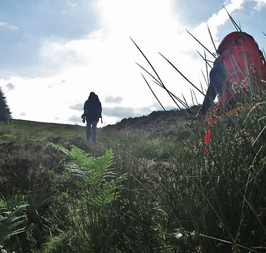
The Irfon has a wild and remote start up on Bryn Garw. Peat bog is the order of the day up here but if you like your mountains free of people then follow the river from source (see map above) but expect a sweat on. Further down is the amazing Abergwesyn valley, which leads to woodland trails in the Irfon valley. This is a river valley after our own hearts.
10 Enter
River Angidy/Lower
Location: Llanishen
Parking: Angidy Tintern GR SO526001
Public Transport: 69 Monmouth/Chepstow
Source GR: SO489028
Length Flow: 6.5 Miles
Nearest Town to Source: Monmouth

You can follow the Angidy and the Angidy trail from it's confluence at Tintern all the way up through the wooded valley. There's industrial history to consider, enchanting places to chow down in and even pools where fisherman kick back to a leisurely old time just off the main Wye Valley (Google Map). It's peaceful and worth an amble and a ramble up into the woods.


11 Enter
River Trothy/Lower
Location:Campston
Monmouthshire (Map)
Parking: Hunters Moon
Public Transport: X3 Pandy
Source GR: SO369220
Length Flow: 28 Miles
Nearest Town to Source: Abergavenny
The Trothy starts in a gully on Campston Hill with the Skirrid Fawr and the Sugar Loaf looming overhead. With numerous trails to traverse you're afforded some unique views of these iconic peaks while nearby the 12th C Hunters Moon Inn serves as a good place to stop by. Further on above the Trothy valley White Castle beckons an explore. One of the best preserved of the Marches castles this area and river will keep you lingering.
12 Enter
River Dore
Location: Merbach Hill
Parking: Arthurs Stone GR SO319431
Public Transport: T14 Dorstone
Source GR: SO307440
Length Flow: 12 MIles
Nearest Town to Source: Hay-On-Wye

Merbach Hill, the source of the Dore, is worth a walk up. The views of the Wye valley to the North East are spectacular as are those towards the Black Mountains. The Dore, a river known for its Brown Trout and Grayling, starts in a garden. It then flows through the beautiful Golden Valley before entering the Monnow at Pontrilas but not before passing by the incredible 11th c Dore Abbey. There's a pleasant walk along the river starting at the Abbey.

13 Enter
River Elan
Location: Banc Yr Wyn/Ceredigion Wales (Map)
Parking: Mt Car Park GR SN853758
Public Transport: X47 Llandrindod/Rhayader
Source GR: SN812733
Length Flow: 23 Miles
Nearest Town to Source: Rhayader
Another mountain river the Elan gives the super far out Elan Valley its name. Starting up on Banc Yr Wyn this is a bog fest but a good one. If you like it desolate with nobody to bother you then follow the Elan from source. It will take you through the valley, passed all the reservoirs, through wooded vales and beyond to the Wye. It's a great trail. We call it the 'Wild Elan Way.'
14 Enter
River Bachawy
Location: Llanbedr Hill
Parking: Roast Ox Inn or GR SO147482
Public Transport: T14 Hay On Wye
Source GR: SO153488
Flow 14 Miles
Nearest Town to Source: Hay-On-Wye

The Bachawy? How do you think you pronounce this little beauty? It's pronounced the Ba - howee. Starting up on Llanbedr hill famed for the hermit of Llanbedr the Bachaway flows through a pleasant valley with a bloody medieval history at Painscastle. Home to drovers to it's a tributary that forces reflection upon you as well as sooths.
.jpg)
15 Enter
River Ithon
Location: Blaenithon
Parking: Cider House GR SO109849
Public Transport: T4 Llandrindod/Newtown
Source GR: SO102848
Length Flow: 53 Miles
Nearest Town to Source: Newtown
The Ithon starts in wild rugged farming country where sheep die and melt into the embryonic waters. Home to Trout and Grayling the Ithon flows through incredible Mid Wales past great hills such as Beddugre Hill where the valley of Abbey Cwm Hir can be seen and the Lugg source to the East. Peny Bont is on route where the old Thomas shop can be explored. Definitely a must! Across the way is Llandegley Rocks birth place of the EDW whilst in its midst is an old castle and an enchanting bridge. This ones worth walking the length of. Well, they all are.
16 Enter
River Tarennig & Bidno
Location: Pen Pumlumon Fawr
Esgair Y Maesnant
(Tarennig Map 1) (Bidno Map 2)
County: Ceredigion Wales
Parking: Pont Rhydgaled GR SN840826
Public Transport: X47 Llandrindod/Aber
Length Flow: Tarennig 5 Miles Bidno 6 Miles
Source GR: 1 SN794864 2 SN837858
Nearest Town to Source: Aberystwyth

A short mountain Wye stream the Tarennig packs a punch in terms of its setting. Quit simply it's the water course that keeps you company as you walk up to the barren summit of Plynlimon from Eisteddfa Gurig. Some rain chasers paddle it for its steep fast flowing waters in full spate. We can testify it does flow fast and full when wet. With many streams coming off the mountain this is a water world to savor as is the Bidno, which has forest for company.

17 Enter
River Marteg
Location: Draenllwyn Glas Fach/Powys (Map)
Parking: Church Bwlch Y Sarnau GR SO029746
Public Transport: T4 Llandrindod/Llanbadarn F
Source GR: SO035793
Length Flow: 12 Miles,
Nearest Town to Source: Rhayader
We met Rhydian the farmer up at source, which lent the river Marteg a friendly air. A humble stream it flows through a wide valley. At the base of the boggy source with great views of Mid Wales is Bwlch Y Sarnau a hamlet where you can refresh everything at the Glyndwr’s Way Cafe. The best stretch of the river however must be the incredible Gilfach Valley and Nature Reserve. Cathedral like with slopes either side this is where the Salmon spawn. Well worth a walk along its banks.
16 Enter
River Wye
Location: Pumlumon Fawr
Parking: Pont Rhydgaled GR SN840826
Public Transport: X47 Llandrindod/Aberystwyth
Source GR: SN801871
Length Flow: 136 Miles
Nearest Town to Source:

The River Wye has been voted Britain's favorite river and its easy to see why when considering its start inside the mighty Plynlimon massif on the Eastern slopes of Plynlimon. We walked its 136 miles in 2020 and was stoked every step of the way as it meandered through Mid Wales with its undulating hills and market towns, into England and then back into Wales to finish its journey at the River Severn in Chepstow. Hiking it is well worth it as is the preservation of it.